Polk County | |
|---|---|
 Polk County Courthouse in Bolivar | |
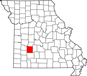
 Location within the U.S. state of Missouri | |
 Missouri's location within the U.S. | |
| Coordinates: 37°37′N 93°24′W / 37.62°N 93.4°W | |
| Country | |
| State | |
| Founded | March 13, 1835 |
| Named for | Ezekiel Polk |
| Seat | Bolivar |
| Largest city | Bolivar |
| Area | |
| • Total | 642 sq mi (1,660 km2) |
| • Land | 636 sq mi (1,650 km2) |
| • Water | 6.9 sq mi (18 km2) 1.1% |
| Population (2020) | |
| • Total | 31,519 |
| • Density | 49/sq mi (19/km2) |
| Time zone | UTC−6 (Central) |
| • Summer (DST) | UTC−5 (CDT) |
| Congressional district | 4th |
Polk County is a county located in the southwestern portion of the U.S. state of Missouri. As of the 2020 census, the population was 31,519.[1] Its county seat is Bolivar.[2] The county was organized January 5, 1835,[3] and named for Ezekiel Polk.
Polk County is part of the Springfield, MO Metropolitan Statistical Area.
- ^ "Polk County, Missouri". United States Census Bureau. Retrieved June 14, 2023.
- ^ "Find a County". National Association of Counties. Retrieved June 7, 2011.
- ^ Laws of a public and general nature of the State of Missouri passed between the years 1824 & 1836" Volume II, published 1842, pg. 432-433 https://mdh.contentdm.oclc.org/digital/collection/molaws/id/42050/rec/3