This article needs additional citations for verification. (February 2010) |
Polzeath
| |
|---|---|
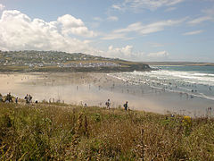
 The Beach at Polzeath | |
Location within Cornwall | |
| Population | 1,449 (2001 Census, includes Trebetherick) |
| OS grid reference | SW937788 |
| Unitary authority | |
| Ceremonial county | |
| Region | |
| Country | England |
| Sovereign state | United Kingdom |
| Post town | POLZEATH |
| Postcode district | PL27 |
| Dialling code | 01208 |
| Police | Devon and Cornwall |
| Fire | Cornwall |
| Ambulance | South Western |
| UK Parliament | |

Polzeath (/pəlˈzɛθ/;Standard Written Form: Polsegh, meaning dry creek) is a small seaside resort village in the civil parish of St Minver[1] in Cornwall, England, United Kingdom. It is approximately 6 miles (9.7 km) north west of Wadebridge on the Atlantic coast.[2]
Polzeath has a sandy beach and is popular with holiday-makers and surfers. The beach is 1,500 feet (460 m) wide and extends 1,200 feet (370 m) from the seafront at low water; however, most of the sand is submerged at high water.[2] At exceptionally high spring tides the sea floods the car park at the top of the beach.
Polzeath beach is patrolled by lifeguards during the summer and is described on the RNLI website as "a wide, flat beach with some shelter from winds, it sees good quality surf and is quite often extremely crowded".[3]
Dolphins may sometimes be spotted in the bay and the coastline north of Polzeath is a good area for seeing many types of birds, particularly on migration but also including occasional puffins nesting on the offshore islands.[4]
The main street runs along the seafront and has a parade of shops catering for holidaymakers and residents. There are pubs, cafés, restaurants, a caravan site and several camping sites in the immediate area. The road rises up steep hills at both ends of the seafront, towards the village of Trebetherick to the southwest and New Polzeath to the northeast.[2]

The South West Coast Path runs from Daymer Bay in the South through Polzeath and up to Pentire Head in the North.[5]
- ^ "Cornwall Council interactive mapping". Archived from the original on 27 September 2013. Retrieved 1 May 2010. Cornwall Council online mapping. Retrieved June 2010
- ^ a b c Ordnance Survey: Landranger map sheet 200 Newquay & Bodmin ISBN 978-0-319-22938-5
- ^ "RNLI - Royal National Lifeboat Institution - Saving Lives at Sea". Archived from the original on 28 November 2010. Retrieved 2 June 2010. RNLI Lifeguards, Polzeath. Retrieved June 2010
- ^ "Pentire Point and The Rumps". Retrieved 9 May 2023.
- ^ "Pentirely Superb - Print walk - South West Coast Path". www.southwestcoastpath.org.uk. Retrieved 27 December 2017.
