| Pomeroon River | |
|---|---|
 | |
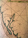
 Old Map of Pomeroon River (1688) | |
| Location | |
| Country | Guyana Claimed by |
| Physical characteristics | |
| Mouth | Atlantic Ocean |
• coordinates | 7°37′N 58°45′W / 7.617°N 58.750°W |
• elevation | Sea level |
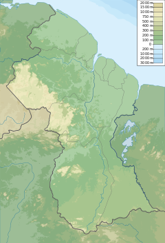
The Pomeroon River (also Río Pomerón[1][2] or Pomaron[3]) is located in Guyana, South America, situated between the Orinoco and the Essequibo rivers. The area has long been inhabited by Lokono people. The Pomeroon River is also one of the deepest rivers in Guyana.
Pomeroon is within the Guyana coastal plain and the area is populated with mangrove swamp vegetation. Siriki Creek is an estuary of the Pomeroon River.[4] The mouth of the river has been deflected from pouring straight into the Atlantic ocean by a sandy spit that redirects the river to the northwest via the Cozier Canal.[5]
- ^ Solana, Ana Crespo (2006). América desde otra frontera: la Guayana holandesa (Surinam) : 1680-1795 (in Spanish). Editorial CSIC - CSIC Press. ISBN 9788400084486.
- ^ Ríos, Manuel Alberto Donis (1987). Evolución histórica de la cartografía en Guayana y su significación en los derechos venezolanos sobre el Esequibo (in Spanish). Academia Nacional de la Historia. ISBN 9789802221097.
- ^ Cite error: The named reference
:1was invoked but never defined (see the help page). - ^ Plew, Mark G.; Daggers, Louisa B. "Recent excavations at the Siriki shell mound, north-western Guyana". Retrieved 2021-01-21.
- ^ Bird, Eric (2010-02-25). Encyclopedia of the World's Coastal Landforms. Springer Science & Business Media. pp. 245–246. ISBN 978-1-4020-8638-0.
