Pondera County | |
|---|---|
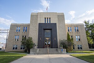
 Pondera County Courthouse | |
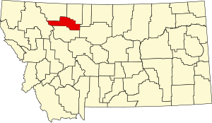
 Location within the U.S. state of Montana | |
 Montana's location within the U.S. | |
| Coordinates: 48°14′N 112°13′W / 48.24°N 112.22°W | |
| Country | |
| State | |
| Founded | April 1, 1919[1] |
| Named for | Pend d'Oreilles people |
| Seat | Conrad |
| Largest city | Conrad |
| Area | |
• Total | 1,640 sq mi (4,200 km2) |
| • Land | 1,623 sq mi (4,200 km2) |
| • Water | 17 sq mi (40 km2) 1.0% |
| Population (2020) | |
• Total | 5,898 |
• Estimate (2022) | 6,078 |
| • Density | 3.6/sq mi (1.4/km2) |
| Time zone | UTC−7 (Mountain) |
| • Summer (DST) | UTC−6 (MDT) |
| Congressional districts | 1st, 2nd |
| Website | www |
| |
Pondera County (/ˌpɒndəˈreɪ/ POND-ə-RAY)[2] is a county in the U.S. state of Montana. As of the 2020 census, the population was 5,898.[3] Its county seat is Conrad.[4]
- ^ "Pondera County Montana". www.ponderacountymontana.org. Retrieved April 3, 2018.
- ^ Wilson, Kurt (September 15, 2015). "The Montana pronunciation guide". Billings Gazette. Retrieved November 8, 2019.
- ^ "State & County QuickFacts". United States Census Bureau. Retrieved May 8, 2023.
- ^ "Find a County". National Association of Counties. Retrieved June 7, 2011.