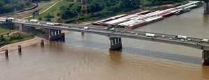
Poplar Street Bridge | |
|---|---|
 | |
| Coordinates | 38°37′05″N 90°10′59″W / 38.61806°N 90.18306°W |
| Carries | 9 lanes of |
| Crosses | Mississippi River |
| Locale | St. Louis, Missouri, and East St. Louis, Illinois |
| Official name | Congressman William L. Clay Sr. Bridge |
| Maintained by | Missouri Department of Transportation |
| Characteristics | |
| Design | Steel girder bridge |
| Total length | 2,164 ft (660 m) |
| Width | 104 ft (32 m) |
| Longest span | 600 feet (183 m) |
| Clearance below | 92 ft (28 m) |
| History | |
| Opened | 1967 |
| Statistics | |
| Daily traffic | 106,500 (2014)[1] |
| Location | |
 | |
The Congressman William L. Clay Sr. Bridge, formerly known as the Bernard F. Dickmann Bridge and popularly as the Poplar Street Bridge or PSB, completed in 1967, is a 647-foot-long (197 m) deck girder bridge across the Mississippi River between St. Louis, Missouri, and East St. Louis, Illinois. The bridge arrives on the Missouri shore line just south of the Gateway Arch.
- ^ "IDOT: New bridge carrying less traffic than originally expected". Belleville News Democrat. April 14, 2014. Archived from the original on July 14, 2014. Retrieved July 5, 2014.