| Popovo Polje | |
|---|---|
| Попово поље | |
 | |
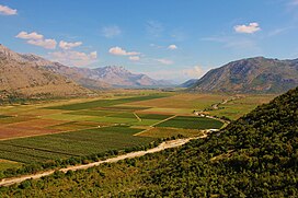
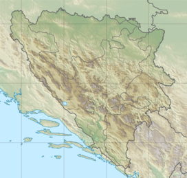
Popovo Polje in Dinaric Alps of Bosnia and Herzegovina | |
| Floor elevation | 270 to 300 metres (890 to 980 ft) |
| Length | 65 km (40 mi) ESE-WNW |
| Width | 0.8 to 7 kilometres (0.50 to 4.35 mi) |
| Area | 250.5 km2 (96.7 sq mi) |
| Depth | 200 to 700 metres (660 to 2,300 ft) |
| Naming | |
| English translation | Popovo field |
| Geography | |
| Country | Bosnia and Herzegovina |
| Population center | Trebinje |
| Borders on | |
| Coordinates | 42°52′N 18°00′E / 42.86°N 18°E |
| River | Trebišnjica |
Popovo Polje (Serbo-Croatian: Popovo polje / Попово поље, pronounced [pɔ̌pɔʋɔ pɔ̂ʎɛ], is a polje (karstic field) in Bosnia and Herzegovina, located in a southernmost region of the country, near the Adriatic coast. Its size is 5.9 square kilometres (2.3 sq mi).
Popovo polje is one of the most famous polje (karstic plains) in Bosnia and Herzegovina and the world, for its karstic phenomenons and features, and particularly the Trebišnjica river, which flows through the polje as the largest sinking river (also losing stream, or influent stream) in the world, as well as the Vjetrenica cave system, located to the west/south-western parts of the valley.
