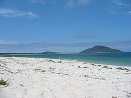
Port Stephens, an open youthful tide-dominated drowned-valley estuary,[1] is a large natural harbour of approximately 134 square kilometres (52 sq mi)[2] located in the Hunter and Mid North Coast regions of New South Wales, Australia.[3]
Port Stephens lies within the Port Stephens–Great Lakes Marine Park and is situated about 160 kilometres (99 mi) north-east of Sydney. The harbour lies wholly within the local government area of Port Stephens; although its northern shoreline forms the boundary between the Port Stephens and MidCoast local government areas.[4]
According to the 2006 census, more than 26,000 people lived within 3 km (1.9 mi) of its 113 km (70 mi) long shoreline and more than 32,000 lived within 10 km (6 mi).[5]
- ^ a b Roy, P. S; Williams, R. J; Jones, A. R; Yassini, I; et al. (2001). "Structure and Function of South-east Australian Estuaries". Estuarine, Coastal and Shelf Science. 53: 351–384. doi:10.1006/ecss.2001.0796.
- ^ a b c d e Cite error: The named reference
OEHwas invoked but never defined (see the help page). - ^ "Port Stephens". Land and Property Management Authority - Spatial Information eXchange. New South Wales Land and Property Information. Retrieved 8 July 2008.
- ^ "Port Stephens". Geographical Names Register (GNR) of NSW. Geographical Names Board of New South Wales. Retrieved 8 July 2008.
- ^ Consolidated population figures from the Australian Bureau of Statistics 2006 census

