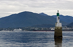
| Port of Prince Rupert | |
|---|---|
 Port of Prince Rupert in 2005 | |
 Click on the map for a fullscreen view | |
| Location | |
| Country | Canada |
| Location | Prince Rupert, British Columbia |
| Coordinates | 54°17′18″N 130°21′22″W / 54.2883°N 130.3562°W |
| UN/LOCODE | CA PRR[1] |
| Details | |
| Opened | 1914 |
| Land area | 667,731 hectares (1,650,000 acres) |
| No. of berths | 5 |
| Draft depth | −16 m (−52 ft) |
| Rail lines | |
| President & CEO | Shaun Stevenson |
| Board Chair | Frans Tjallingi |
| Statistics | |
| Annual cargo tonnage | 29.84 million metric revenue tons (CY 2019)[2] |
| Annual container volume | 1.21 million twenty-foot equivalent units (TEU) (CY 2019)[2] |
| Passenger traffic | 12,435 passengers (CY 2019)[2] |
| Website www | |
The Port of Prince Rupert is a seaport managed by the Prince Rupert Port Authority that occupies 667,731 hectares (1,650,000 acres) of land and water along 20 kilometres (12 miles) of waterfront. The port is located in Prince Rupert Harbour in the North Coast Regional District of British Columbia.
The Port of Prince Rupert is the third busiest seaport in Canada by container volume and cargo tonnage after the Port of Vancouver and Port of Montreal.[2]
- ^ "UNLOCODE (CA) – CANADA". www.unece.org. UNECE. Retrieved 9 September 2020.
- ^ a b c d "CY 2019 Western Hemisphere Port Cargo and Passenger Counts". www.aapa-ports.org. Retrieved 2020-09-08.