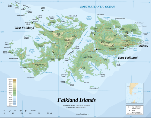
A topographic map of the Falkland Islands, an archipelago in the South Atlantic Ocean, located 480 km (300 mi) off the coast of Argentina. They consist of two main islands, East Falkland and West Falkland, together with about 700 smaller islands. Stanley, on East Falkland, is the capital and largest city. The islands are a self-governing overseas territory of the United Kingdom. Claimed by Argentina.