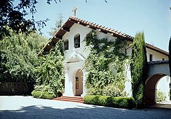
Portola Valley, California | |
|---|---|
| Town of Portola Valley | |
 | |
 Location in San Mateo County and the state of California | |
| Coordinates: 37°22′30″N 122°13′7″W / 37.37500°N 122.21861°W | |
| Country | United States |
| State | California |
| County | San Mateo |
| Incorporated | July 14, 1964[1] |
| Named for | Gaspar de Portolá |
| Government | |
| • Mayor | Sarah Wernikoff[2] |
| • Vice Mayor | Craig Hughes[2] |
| Area | |
• Total | 9.08 sq mi (23.53 km2) |
| • Land | 9.08 sq mi (23.52 km2) |
| • Water | 0.00 sq mi (0.00 km2) 0.02% |
| Elevation | 459 ft (140 m) |
| Population | |
• Total | 4,456 |
| • Density | 490/sq mi (190/km2) |
| Time zone | UTC-8 (PST) |
| • Summer (DST) | UTC-7 (PDT) |
| ZIP code | 94028 |
| Area code | 650 |
| FIPS code | 06-58380 |
| GNIS feature ID | 1659786 |
| Website | www |
Portola Valley is an incorporated town in San Mateo County, California, United States. Located on the San Francisco Peninsula in the Bay Area, Portola Valley is a small, wealthy community nestled on the eastern slopes of the Santa Cruz Mountains.[5][6]
- ^ "California Cities by Incorporation Date" (Word). California Association of Local Agency Formation Commissions. Retrieved August 25, 2014.
- ^ a b "Town Council". Portola Valley, CA. Retrieved October 18, 2024.
- ^ "2019 U.S. Gazetteer Files". United States Census Bureau. Retrieved July 1, 2020.
- ^ "Census Data: Portola Valley (town)". United States Census Bureau. Retrieved July 14, 2021.
- ^ Cite error: The named reference
income94028was invoked but never defined (see the help page). - ^ Cite error: The named reference
SJMN_2024-04-02was invoked but never defined (see the help page).

