Potosi, Missouri | |
|---|---|
 Washington County Courthouse | |
| Motto: A City for All Seasons | |
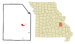
 Location of Potosi, Missouri | |
| Coordinates: 37°56′01″N 90°46′30″W / 37.93361°N 90.77500°W[1] | |
| Country | United States |
| State | Missouri |
| County | Washington |
| Incorporated | 1826 |
| Area | |
• Total | 2.33 sq mi (6.03 km2) |
| • Land | 2.33 sq mi (6.03 km2) |
| • Water | 0.00 sq mi (0.00 km2) |
| Elevation | 991 ft (302 m) |
| Population (2020) | |
• Total | 2,538 |
| • Density | 1,090.21/sq mi (420.86/km2) |
| Time zone | UTC−6 (Central (CST)) |
| • Summer (DST) | UTC−5 (CDT) |
| ZIP code | 63664 |
| Area code | 573 |
| FIPS code | 29-59330[3] |
| GNIS feature ID | 2396262[1] |
Potosi is a city in Washington County, Missouri, United States. Potosi is seventy-two miles southwest of St. Louis. The population was 2,538 as of the 2020 census. It is the county seat of Washington County.[4]
Located in the Lead Belt, the city was founded in 1763 by French colonists as Mine à Breton or Mine au Breton. After the United States acquired this area, American Moses Austin renamed the community for the Bolivian silver-mining city of Potosí. He was involved in lead mining. [5]
- ^ a b c U.S. Geological Survey Geographic Names Information System: Potosi, Missouri
- ^ "ArcGIS REST Services Directory". United States Census Bureau. Retrieved August 28, 2022.
- ^ "U.S. Census website". United States Census Bureau. Retrieved January 31, 2008.
- ^ "Find a County". National Association of Counties. Retrieved June 7, 2011.
- ^ "Moses Austin". Archived from the original on December 20, 2015. Retrieved February 11, 2010.