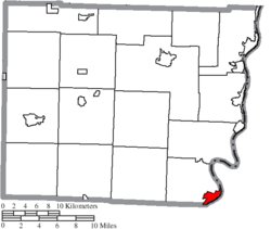
Powhatan Point, Ohio | |
|---|---|
 Houses on Main Street | |
 Location of Powhatan Point, Ohio | |
 Location of Powhatan Point in Belmont County | |
| Coordinates: 39°51′55″N 80°47′50″W / 39.86528°N 80.79722°W | |
| Country | United States |
| State | Ohio |
| County | Belmont |
| Township | York |
| Area | |
• Total | 1.63 sq mi (4.23 km2) |
| • Land | 1.47 sq mi (3.81 km2) |
| • Water | 0.16 sq mi (0.42 km2) |
| Elevation | 646 ft (197 m) |
| Population (2020) | |
• Total | 1,461 |
| • Density | 993.88/sq mi (383.87/km2) |
| Time zone | UTC-5 (Eastern (EST)) |
| • Summer (DST) | UTC-4 (EDT) |
| ZIP code | 43942 |
| Area code | 740 |
| FIPS code | 39-64542[3] |
| GNIS feature ID | 2399016[2] |
Powhatan Point is a village in southeastern Belmont County, Ohio, United States, along the Ohio River. The population was 1,461 at the 2020 census. It is part of the Wheeling metropolitan area.
While "Powhatan" likely memorializes the Native-American tribe of the same name, the "Point" in the town's name refers to the confluence between the Captina Creek and the Ohio River. Powhatan Point is the closest town on the Ohio side of Captina Island in the Ohio River.
- ^ "ArcGIS REST Services Directory". United States Census Bureau. Retrieved September 20, 2022.
- ^ a b U.S. Geological Survey Geographic Names Information System: Powhatan Point, Ohio
- ^ "U.S. Census website". United States Census Bureau. Retrieved January 31, 2008.