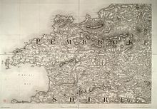


The Preseli Mountains (English: /prəˈsɛli/, prə-SEL-ee; Welsh: Mynyddoedd y Preseli or Y Preselau), also known as the Preseli Hills, or just the Preselis, is a range of hills in western Wales, mostly within the Pembrokeshire Coast National Park and entirely within the county of Pembrokeshire.
The range stretches from the proximity of Newport in the west to Crymych in the east, some 13 miles (21 km) in extent. The highest point at 1,759 feet (536 m) above sea level is Foel Cwmcerwyn. The ancient 8 miles (13 km) of track along the top of the range is known as the Golden Road.[1][2]
The Preselis have a diverse ecosystem, many prehistoric sites, and are a popular tourist destination. There are scattered settlements and small villages; the uplands provide extensive unenclosed grazing, and the lower slopes are mainly enclosed pasture.
Slate quarrying was once an important industry. More recently, igneous rock is being extracted. The Preselis have Special Area of Conservation status, and there are three sites of special scientific interest (SSSIs).
- ^ "BBC: Wales nature and outdoors". BBC. Retrieved 22 November 2013.
- ^ "The Golden Road". Pembrokeshire Coast National Park Authority. Retrieved 14 February 2023.