Prijepolje
Пријепоље (Serbian) | |
|---|---|
Town and municipality | |
|
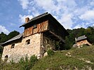
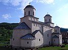
From top: Prijepolje Old Town, Monument to St. Sava, Prijepolje Clock tower, Old mills on waterfall Sopotnica, Mileševa monastery | |
 Location of the municipality of Prijepolje within Serbia | |
| Coordinates: 43°23′N 19°38′E / 43.383°N 19.633°E | |
| Country | |
| Region | Šumadija and Western Serbia |
| District | Zlatibor |
| First time mentioned | 7 July 1343 |
| Settlements | 96 |
| Government | |
| • Mayor | Drago Popadić (SNS) |
| Area | |
| • Town | 9.67 km2 (3.73 sq mi) |
| • Municipality | 827 km2 (319 sq mi) |
| Elevation | 557 m (1,827 ft) |
| Highest elevation | 1,734 m (5,689 ft) |
| Lowest elevation | 440 m (1,440 ft) |
| Population (2022 census)[2] | |
| • Town | 11,928 |
| • Town density | 1,200/km2 (3,200/sq mi) |
| • Municipality | 32,214 |
| • Municipality density | 39/km2 (100/sq mi) |
| Time zone | UTC+1 (CET) |
| • Summer (DST) | UTC+2 (CEST) |
| Postal code | 31300 |
| Area code | +381(0)33 |
| Car plates | PP |
| Website | www |
Prijepolje (Serbian Cyrillic: Пријепоље, pronounced [prijěːpoʎe]) is a town and municipality located in the Zlatibor District of southwestern Serbia. As of 2022, the town has 11,928 inhabitants, while the municipality has 32,214 inhabitants.[3]
- ^ "Municipalities of Serbia, 2006". Statistical Office of Serbia. Retrieved 2010-11-28.
- ^ "2011 Census of Population, Households and Dwellings in the Republic of Serbia: Comparative Overview of the Number of Population in 1948, 1953, 1961, 1971, 1981, 1991, 2002 and 2011, Data by settlements" (PDF). Statistical Office of Republic Of Serbia, Belgrade. 2014. ISBN 978-86-6161-109-4. Retrieved 2014-06-27.
- ^ "2022 Census of Population, Households and Dwellings" (PDF). Retrieved 2023-12-07.


