| Prince Albert National Park | |
|---|---|
 Lake Waskesiu in Prince Albert National Park | |
| Location | Saskatchewan, Canada |
| Nearest city | Prince Albert |
| Coordinates | 53°57′48″N 106°22′12″W / 53.96333°N 106.37000°W |
| Area | 3,874 km2 (1,496 sq mi) |
| Established | March 24, 1927 |
| Visitors | 287,372 (in 2022–23[1]) |
| Governing body | Parks Canada |
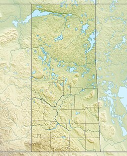
Prince Albert National Park encompasses 3,874 square kilometres (1,496 sq mi) in central Saskatchewan, Canada and is about 200 kilometres (120 mi) north of Saskatoon. Though declared a national park March 24, 1927, official opening ceremonies weren't performed by Prime Minister William Lyon Mackenzie King until August 10, 1928.[2] This park is open all year but the most visited period is from May to September. Although named for the city of Prince Albert, the park's main entrance is actually 80 kilometres (50 mi) north of that city via Highways 2 and 263, which enters the park at its southeast corner. Two additional secondary highways enter the park, Highway 264, which branches off Highway 2 just east of the Waskesiu townsite, and Highway 240, which enters the park from the south and links with 263 just outside the entry fee-collection gates. Prince Albert National Park is not located within any rural municipality, and is politically separate from the adjacent Northern Saskatchewan Administration District (NSAD). Until the establishment of Grasslands National Park in 1981, it was the province's only national park.
The hamlet of Waskesiu Lake is the only community within the park and it is located on the southern shore of Waskesiu Lake. Most facilities and services one would expect to find in a multi-use park are available there, such as shopping, fuel, and lodging.
About 90% of the park is in the Waskesiu Hills and elevations range from 488 metres (1,601 ft) on the western side to 724 metres (2,375 ft) on the eastern side.[3] There are several large lakes in the park, including Waskesiu, Kingsmere, and Crean, and several notable rivers have their source there, such as Spruce, Sturgeon, and Smoothstone.
The park's development as a recreation destination has led to the region immediately south-east of the park boundaries – locations such as Christopher Lake, Emma Lake, Sunnyside Beach, and Anglin Lake, themselves becoming popular recreation destinations. Additional development has taken place just beyond the park's eastern entry.
- ^ Canada, Parks. "Parks Canada attendance 2022_23 - Parks Canada attendance 2022_23 - Open Government Portal". open.canada.ca. Retrieved May 7, 2024.
- ^ "Prince Albert National Park of Canada – Park Era History". Parks Canada. August 10, 2009. Retrieved February 11, 2010.
- ^ "The Encyclopedia of Saskatchewan | Details".

