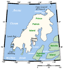
 Prince Patrick Island, showing the Mould Bay weather station | |
 | |
| Geography | |
|---|---|
| Location | Northern Canada |
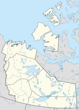
| Coordinates | 76°45′02″N 119°30′12″W / 76.75056°N 119.50333°W[1] |
| Archipelago | Queen Elizabeth Islands Arctic Archipelago |
| Area | 15,848 km2 (6,119 sq mi) |
| Area rank | 55th |
| Highest elevation | 279 m (915 ft) |
| Highest point | unnamed |
| Administration | |
Canada | |
| Territory | Northwest Territories |
| Demographics | |
| Population | Uninhabited |
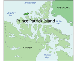
A member of the Arctic Archipelago, Prince Patrick Island is the westernmost of the Queen Elizabeth Islands in the Northwest Territories of Canada, lying northwest of Melville Island. The area of Prince Patrick Island is 15,848 km2 (6,119 sq mi),[2] making it the 55th largest island in the world and Canada's 14th largest island. It has historically been icebound all year, making it one of the least accessible parts of Canada. Located at the entrance of the M'Clure Strait, Prince Patrick Island is uninhabited.
The first known sighting of the island was in 1853 by the Irish naval officer George Mecham, when it was explored by him and his fellow Irish explorer Francis Leopold McClintock in the spring of that year during the Edward Belcher expedition.[3] Much later, it was named for Prince Arthur William Patrick, Duke of Connaught, who was Governor General of Canada from 1911 to 1916.
The island rises to only about 279 m (915 ft),[4] and the area is seismically active.
- ^ "Prince Patrick Island". Geographical Names Data Base. Natural Resources Canada.
- ^ Prince Patrick Island Archived 2013-01-22 at the Wayback Machine at the Atlas of Canada
- ^ M'Dougall, George F. (1857). The eventful voyage of H.M. discovery ship "Resolute" to the Arctic regions, in search of Sir John Franklin and the missing crews of H.M. discovery ships "Erebus" and "Terror," 1852, 1853, 1854. London: Longman, Brown, Green, Longmans, & Roberts. p. 452.
The Eventful Voyages of HMS Resolute.
- ^ Prince Patrick Island High Point, Northwest Territories

