Princeton, New Jersey | |
|---|---|
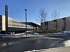
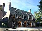
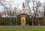
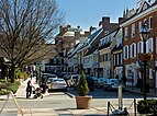
Lower Pyne building on the corner of Nassau Street and Witherspoon Street, 2015 Nassau Street northbound in Downtown Princeton, 2017 Princeton station, 2020 McCarter Theatre, 2018 Nassau Hall on the campus of Princeton University, 2019 Princeton Battlefield, 2007 Palmer Square, 2013 | |
 Location of Princeton in Mercer County and in New Jersey | |
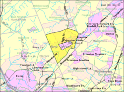 | |
Location in Mercer County Location in New Jersey | |
| Coordinates: 40°21′30″N 74°40′00″W / 40.358244°N 74.666728°W[1][2] | |
| Country | |
| State | |
| County | Mercer |
| Incorporated | January 1, 2013 |
| Government | |
| • Type | Borough |
| • Mayor | Mark Freda (D, term ends December 31, 2024)[3][4] |
| • Administrator | Bernard Hvozdovic Jr.[5] |
| • Municipal clerk | Delores Williams[6] |
| Area | |
• Total | 18.41 sq mi (47.69 km2) |
| • Land | 17.95 sq mi (46.48 km2) |
| • Water | 0.47 sq mi (1.21 km2) 2.53% |
| • Rank | 154th of 565 in state 6th of 12 in county[1] |
| Population | |
• Total | 30,681 |
| 30,289 | |
| • Rank | 78th of 565 in state 5th of 12 in county[11] |
| • Density | 1,709.6/sq mi (660.1/km2) |
| • Rank | 319th of 565 in state 8th of 12 in county[11] |
| Time zone | UTC−05:00 (Eastern (EST)) |
| • Summer (DST) | UTC−04:00 (Eastern (EDT)) |
| ZIP Codes | |
| Area code | 609[14] |
| FIPS code | 3402160900[15] |
| Website | www |
Princeton is a borough in Mercer County, in the U.S. state of New Jersey. It was established on January 1, 2013, through the consolidation of the Borough of Princeton and Princeton Township, both of which are now defunct. As of the 2020 United States census, the borough's population was 30,681,[8] an increase of 2,109 (+7.4%) from the 2010 census combined count of 28,572.[9] In the 2000 census, the two communities had a total population of 30,230, with 14,203 residents in the borough and 16,027 in the township.[16]
Princeton was founded before the American Revolutionary War. The borough is the home of Princeton University, one of the world’s most acclaimed research universities, which bears its name and moved to the community in 1756 from the educational institution's previous location in Newark. Although its association with the university is primarily what makes Princeton a college town, other important institutions in the area include the Institute for Advanced Study, Princeton Plasma Physics Laboratory, Princeton Theological Seminary, Opinion Research Corporation, Bristol-Myers Squibb, Siemens Corporate Research, SRI International, FMC Corporation, Educational Testing Service, The Robert Wood Johnson Foundation, Amrep, Church and Dwight, Berlitz International, and Dow Jones & Company.
Princeton is roughly equidistant from New York City and Philadelphia.[17] It is close to many major highways that serve both cities (e.g., Interstate 95 and U.S. Route 1), and receives major television and radio broadcasts from each. It is also close to Trenton, New Jersey's capital city, New Brunswick and Edison.
The New Jersey governor's official residence has been in Princeton since 1945, when Morven (in what was then Princeton Borough) became the first governor's mansion. In 1982, it was replaced by the larger Drumthwacket, a colonial mansion located in the former township, but not all have actually lived in these houses. Morven became a museum and garden, owned and operated by the New Jersey Historical Society.[18]
Throughout much of its history, the community was split into two separate municipalities: a township and a borough. The central borough was completely surrounded by the township. The borough seceded from the township in 1894 in a dispute over school taxes; the two municipalities later formed the Princeton Public Schools, and some other public services were conducted together before they were reunited into a single Princeton in January 2013. Princeton Borough contained Nassau Street, the main commercial street, most of the university campus, and incorporated most of the urban area until the postwar suburbanization. The borough and township had roughly equal populations. Other major streets include Harrison, Witherspoon, Nassau, Bayard, Washington, and Stockton.[19]
- ^ a b 2019 Census Gazetteer Files: New Jersey Places Archived March 21, 2021, at the Wayback Machine, United States Census Bureau. Accessed July 1, 2020.
- ^ US Gazetteer files: 2010, 2000, and 1990 Archived August 24, 2019, at the Wayback Machine, United States Census Bureau. Accessed September 4, 2014.
- ^ Cite error: The named reference
Mayorwas invoked but never defined (see the help page). - ^ 2023 New Jersey Mayors Directory Archived March 11, 2023, at the Wayback Machine, New Jersey Department of Community Affairs, updated February 8, 2023. Accessed February 10, 2023.
- ^ Administration Archived March 18, 2022, at the Wayback Machine, Municipality of Princeton. Accessed March 9, 2023.
- ^ Clerk Archived March 8, 2022, at the Wayback Machine, Municipality of Princeton. Accessed March 9, 2023.
- ^ "ArcGIS REST Services Directory". United States Census Bureau. Archived from the original on February 13, 2023. Retrieved October 11, 2022.
- ^ a b c Cite error: The named reference
Census2020was invoked but never defined (see the help page). - ^ a b Cite error: The named reference
LWD2020was invoked but never defined (see the help page). - ^ Cite error: The named reference
PopEstwas invoked but never defined (see the help page). - ^ a b Population Density by County and Municipality: New Jersey, 2020 and 2021 Archived March 7, 2023, at the Wayback Machine, New Jersey Department of Labor and Workforce Development. Accessed March 1, 2023.
- ^ Look Up a ZIP Code for Princeton, NJ Archived May 30, 2020, at the Wayback Machine, United States Postal Service. Accessed August 20, 2012.
- ^ Zip Codes Archived June 17, 2019, at the Wayback Machine, State of New Jersey. Accessed August 21, 2013.
- ^ Area Code Lookup - NPA NXX for Princeton, NJ Archived September 22, 2020, at the Wayback Machine, Area-Codes.com. Accessed August 29, 2013.
- ^ Geographic Codes Lookup for New Jersey Archived November 19, 2018, at the Wayback Machine, Missouri Census Data Center. Accessed April 1, 2022.
- ^ Table 7. Population for the Counties and Municipalities in New Jersey: 1990, 2000 and 2010 Archived June 2, 2022, at the Wayback Machine, New Jersey Department of Labor and Workforce Development, February 2011. Accessed May 1, 2023.
- ^ Sullivan, Ronald. "Princeton Adopts Plan for Big Tract" Archived February 18, 2024, at the Wayback Machine, The New York Times, November 4, 1973. Accessed February 18, 2024. "The Princeton development would lie midway between New York City and Philadelphia on approximately 900 acres the university owns and 700 acres to be acquired by the school or developed jointly with its present owners."
- ^ Janson, Donald. "A Tour of Princeton Landmarks" Archived June 27, 2020, at the Wayback Machine, The New York Times, April 30, 1989. Accessed June 25, 2020. "In 1945 the Stockton family sold Morven to Gov. Walter E. Edge. Six years later, while still in office, the Governor donated the mansion to the state with the requirement that it be used as the gubernatorial mansion or a state museum. From 1953 to 1982 Morven was home to the families of four Governors: Robert B. Meyner, Richard J. Hughes, William T. Cahill and Brendan T. Byrne. The National Park Service designated the house a National Historic Landmark in 1972.... After the Byrne family moved out, work began to transform Morven into a state museum. Drumthwacket became the official address of New Jersey governors."
- ^ Historic Princeton Archived March 26, 2024, at the Wayback Machine, Municipality of Princeton. Accessed March 26, 2024.


