Princeville, North Carolina | |
|---|---|
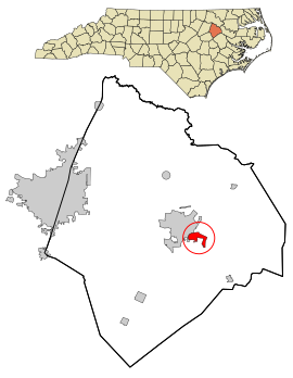
 Location in Edgecombe County and the state of North Carolina. | |
| Coordinates: 35°53′18″N 77°31′44″W / 35.88833°N 77.52889°W | |
| Country | United States |
| State | North Carolina |
| County | Edgecombe |
| Founded | 1865[1] |
| Incorporated | 1885[1] |
| Named for | Turner Prince[1] |
| Area | |
| • Total | 1.52 sq mi (3.94 km2) |
| • Land | 1.51 sq mi (3.91 km2) |
| • Water | 0.01 sq mi (0.03 km2) |
| Elevation | 36 ft (11 m) |
| Population (2020) | |
| • Total | 1,254 |
| • Density | 830.46/sq mi (320.65/km2) |
| Time zone | UTC-5 (Eastern (EST)) |
| • Summer (DST) | UTC-4 (EDT) |
| ZIP code | 27886 |
| Area code | 252 |
| FIPS code | 37-53840[4] |
| GNIS feature ID | 2407162[3] |
| Website | townofprinceville |

Princeville is a town in Edgecombe County, North Carolina, United States established by freed slaves after the Civil War. It was established in 1865 and known as Freedom Hill.[5] It was incorporated in 1885 as Princeville, the first independently governed African American community chartered in the United States.
Princeville is part of the Rocky Mount, North Carolina Metropolitan Statistical Area. As of the 2020 census, the town population was 1,254 residents.[6] The town is on the opposite bank of the Tar River from Tarboro. The city of Rocky Mount is 16 miles (26 km) to the west.
- ^ a b c "North Carolina Gazetteer". Retrieved December 19, 2022.
- ^ "ArcGIS REST Services Directory". United States Census Bureau. Retrieved September 20, 2022.
- ^ a b U.S. Geological Survey Geographic Names Information System: Princeville, North Carolina
- ^ "U.S. Census website". United States Census Bureau. Retrieved January 31, 2008.
- ^ "Freedom Hill Historical Marker".
- ^ "Explore Census Data". data.census.gov. Retrieved October 22, 2022.
