This article needs additional citations for verification. (November 2016) |
Principality of Waldeck and Pyrmont Fürstentum Waldeck und Pyrmont | |||||||||||
|---|---|---|---|---|---|---|---|---|---|---|---|
| 1180–1918 | |||||||||||
| Anthem: "Mein Waldeck" | |||||||||||
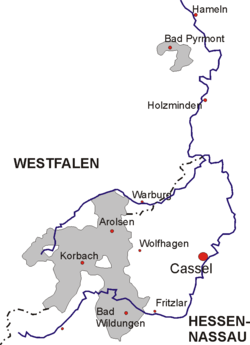
 Waldeck (red) within the German Empire. The small northern territory is Pyrmont while the southern lands are Waldeck. | |||||||||||
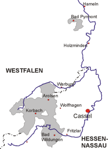
 Map of Waldeck, showing the border between Westphalia and Hesse-Nassau | |||||||||||
| Status | State of the Holy Roman Empire State of the Confederation of the Rhine State of the German Confederation State of the North German Confederation State of the German Empire | ||||||||||
| Capital | Waldeck (to 1655) Arolsen (from 1655) 51°22′N 9°1′E / 51.367°N 9.017°E | ||||||||||
| Common languages | German | ||||||||||
| Religion | United Protestant: Evangelical State Church of Waldeck and Pyrmont | ||||||||||
| Prince | |||||||||||
• 1712–1728 | Friedrich Anton Ulrich (first) | ||||||||||
• 1893–1918 | Friedrich (last) | ||||||||||
| Historical era | Middle Ages | ||||||||||
• Established as a County | 1180 | ||||||||||
• Became Reichsgraf (immediate count) | 1349 | ||||||||||
• Succeeded to Pyrmont | 1625 | ||||||||||
• Raised to Imp. Principality | January 1712 | ||||||||||
• Administered by Prussia | 1868 | ||||||||||
| 1918 | |||||||||||
• Subsumed into Prussia | 1929 | ||||||||||
| Population | |||||||||||
• 1848 | 56,000[1] | ||||||||||
| |||||||||||
| Today part of | Germany | ||||||||||


The County of Waldeck (later the Principality of Waldeck and Principality of Waldeck and Pyrmont) was a state of the Holy Roman Empire and its successors from the late 12th century until 1929. In 1349 the county gained Imperial immediacy and in 1712 was raised to the rank of principality. After the dissolution of the Holy Roman Empire in 1806 it was a constituent state of its successors: the Confederation of the Rhine, the German Confederation, the North German Confederation, and the German Empire. After the abolition of the monarchy in 1918, the renamed Free State of Waldeck-Pyrmont became a component of the Weimar Republic until divided between Hannover and other Prussian provinces in 1929. It comprised territories in present-day Hesse and Lower Saxony (Germany).
- ^ A Pictorial Geography of the World: Comprising a System of Universal Geography, Popular and Scientific. Boston: C.D. Strong. 1848. p. 762.


