| Pripyat Prypiat, Prypiać, Prypeć | |
|---|---|
 Pripyat River | |
 Course of the Pripyat River | |
| Location | |
| Country | Ukraine, Belarus |
| Physical characteristics | |
| Source | |
| • location | Volyn Oblast, Ukraine |
| • coordinates | 51°20′00″N 23°47′26″E / 51.3333°N 23.7905°E |
| Mouth | Dnieper |
• location | Kyiv Reservoir |
• coordinates | 51°09′31″N 30°29′27″E / 51.15861°N 30.49083°E |
| Length | 761 km (473 mi) |
| Basin size | 121,000 km2 (47,000 sq mi) |
| Discharge | |
| • average | 377 m3/s (13,300 cu ft/s) |
| Basin features | |
| Progression | Dnieper→ Dnieper–Bug estuary→ Black Sea |
| Tributaries | |
| • left | Pina, Yaselda, Tsna, Lan, Sluch, Ptsich, Brahinka |
| • right | Turiya, Stokhid, Styr, Horyn, Stsviha, Ubort, Zhelon, Slovechna, Uzh |
 | |


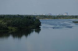
The Pripyat or Prypiat[a] is a river in Eastern Europe. The river, which is approximately 761 km (473 mi) long,[1] flows east through Ukraine, Belarus, and Ukraine again, draining into the Dnieper.
Cite error: There are <ref group=lower-alpha> tags or {{efn}} templates on this page, but the references will not show without a {{reflist|group=lower-alpha}} template or {{notelist}} template (see the help page).
- ^ "Main Geographic Characteristics of the Republic of Belarus. Main characteristics of the largest rivers of Belarus". Land of Ancestors. Data of the Ministry of Natural Resources and Environmental Protection of the Republic of Belarus. 2011. Archived from the original on 15 January 2014. Retrieved 27 September 2013.