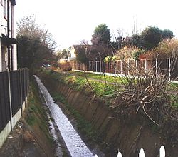

| Prittle Brook | |
|---|---|
 | |
 | |
| Etymology | From the parish of Prittlewell |
| Location | |
| County | Essex |
| District | Castle Point, Southend-on-Sea, Rochford |
| Physical characteristics | |
| Source | |
| • location | Thundersley Essex |
| • coordinates | 51°33'38"N 0°35'40"E |
| Mouth | River Roach, Rochford |
• coordinates | 51°34'27"N 0°42'59"E |
| Length | 11.6 km |
The Prittle Brook is a 7.2 mile (11.59 km) watercourse in south Essex, England. A tributary of the River Roach, the brook rises in Thundersley and passes through Hadleigh, Leigh-on-Sea, Westcliff, Prittlewell, Rochford and discharges into the Roach and then into the North Sea via the Roach and Crouch estuaries.