| Proserpina Dam | |
|---|---|
 | |
| Location | Mérida (Badajoz), Spain |
| Coordinates | 38°58′10″N 6°21′59″W / 38.969544°N 6.366433°W |
| Opening date | 1st–2nd century |
| Dam and spillways | |
| Impounds | Las Pardillas (Guadiana basin) |
| Height | 12 m (39 ft) |
| Length | 427.8 m (1,404 ft) |
| Width (base) | 5.9 m (19 ft) |
| Official name | Proserpina Dam |
| Type | Cultural |
| Criteria | iii, iv |
| Designated | 1993 (17th session) |
| Part of | Archaeological Ensemble of Mérida |
| Reference no. | 664-014 |
| Region | Europe and North America |
| Official name | Pantano de Proserpina |
| Type | Non-movable |
| Criteria | Monument |
| Designated | 13 December 1912 |
| Reference no. | RI-51-0000114 |

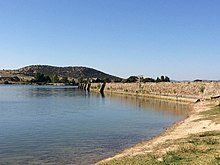
The Proserpina Dam is a Roman gravity dam built to supply water to the Roman colonia of Emerita Augusta –present-day Mérida, Spain–, capital of the Roman province of Lusitania. It was built in the 1st–2nd century AD as part of the infrastructure which supplied water to the city through the aqueduct of the Miracles. After the fall of the Roman Empire, the aqueduct fell into decay, but the earth dam with retaining wall is still in use.[1]
Nowadays the dam and the remains of the aqueduct are part of the Archaeological Ensemble of Mérida, which is one of the largest and most extensive archaeological sites in Spain and that was declared a World Heritage Site by UNESCO in 1993.[2]