Prosperidad | |
|---|---|
 | |
 | |
| Country | Spain |
| Region | Community of Madrid |
| Municipality | Madrid |
| District | Chamartín |
| Area | |
• Total | 1.043284 km2 (0.402814 sq mi) |
| Population (2020) | |
• Total | 37,018 |
| • Density | 35,000/km2 (92,000/sq mi) |
 | |
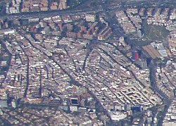
Prosperidad is an administrative neighborhood of Madrid belonging to the district of Chamartín. Its boundaries are: to the west the street Príncipe de Vergara, south: the Calle de María de Molina and Avenida de América, east: the M-30 and north: the street Lopez de Hoyos (one of the longest streets city noted for its great commercial activity.) Padre Claret street and avenue Ramon y Cajal.1
It has an area of 1.043284 km2 (0.402814 sq mi).[1] As of 1 March 2020, it has a population of 37,018.[2]
- ^ "Callejero vigente. Barrios". Ayuntamiento de Madrid.
- ^ "Población por distrito y barrio". Ayuntamiento de Madrid. Retrieved 20 March 2020.