| Protector Shoal | |
|---|---|
 | |
| Summit depth | 55 m (180 ft) |
| Height | 3,900 ft (1,200 m) |
| Location | |
| Location | 50 km (31 mi) NW of Zavodovski Island |
| Group | South Sandwich Islands |
| Coordinates | 55°54′45″S 28°10′03″W / 55.9125°S 28.1675°W[1] |
| Country | United Kingdom |
| Geology | |
| Type | Seamount, Submarine volcano |
| Last eruption | 1962 |
| History | |
| Discovery date | 1962 |
| Discovered by | Royal Navy Ice Patrol Vessel HMS Protector |

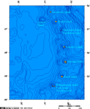
Protector Shoal is the shallowest point of the Protector Seamounts, a group of submarine volcanoes in the Southern Ocean. They are part of the South Sandwich island arc, a volcanic arc that has given rise to the South Sandwich Islands. Protector Shoal reaches a depth of 55 metres (180 ft) below sea level and is part of a larger group of seamounts that formed atop a larger ridge. Some of these seamounts bear traces of sector collapses, and one is capped by nested calderas.
The seamount erupted in 1962, probably during March, and produced a large pumice raft that was swept by ocean currents around Antarctica. Various islands near to or in the Southern Ocean, such as Australia and New Zealand, have had Protector Shoal pumice wash up on their coastlines. Pumice attributed to this eruption has been recovered as far as Hawaii. There have been no eruptions since, but there is ongoing seismicity and underwater hydrothermal venting.
- ^ "Protector Seamounts". Global Volcanism Program. Smithsonian Institution. 2013. Archived from the original on 30 November 2023. Retrieved 19 January 2024.