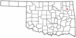
Pryor Creek, Oklahoma | |
|---|---|
| Nickname: A Town For All Seasons | |
 Location of Pryor Creek and Mayes County | |
| Coordinates: 36°17′30″N 95°19′05″W / 36.29167°N 95.31806°W[1] | |
| Country | United States |
| State | Oklahoma |
| County | Mayes |
| Government | |
| • Mayor | Zac Doyle[2] |
| Area | |
| • Total | 10.03 sq mi (25.98 km2) |
| • Land | 9.99 sq mi (25.88 km2) |
| • Water | 0.04 sq mi (0.10 km2) 0.31% |
| Elevation | 627 ft (191 m) |
| Population (2020) | |
| • Total | 9,444 |
| • Density | 944.97/sq mi (364.87/km2) |
| Time zone | UTC-6 (CST) |
| • Summer (DST) | UTC-5 (CDT) |
| ZIP code | 74361, 74362 |
| Area code | 918/539 |
| FIPS code | 40-60950 |
| GNIS feature ID | 2411500[1] |
| Website | www.pryorcreek.org |
Pryor Creek or Pryor[1][4][5] is a city in and county seat of Mayes County, Oklahoma, United States. The population was 8,659 at the 2000 census and 9,539 in the 2010 census.[6]
Originally named Coo-Y-Yah, Cherokee for "place of the huckleberries",[7] it was renamed Pryor Creek in 1887 which was the name of the local railroad station, which in turn was named for the nearby creek. Due to confusion in distinguishing handwritten mailing addresses to Pryor Creek and Pond Creek, the U.S. Postal Service name for the city was shortened to Pryor, and both names are in common usage.
- ^ a b c d U.S. Geological Survey Geographic Names Information System: Pryor Creek, Oklahoma
- ^ "City Council — Pryor Creek, OK". Retrieved May 8, 2023.
- ^ "ArcGIS REST Services Directory". United States Census Bureau. Retrieved September 20, 2022.
- ^ Oklahoma Atlas & Gazeteer, DeLorme, 1st Edition, 1998, p. 36 ISBN 0899332838
- ^ Pryor, OK, 7.5 Minute Topographic Quadrangles, USGS, and 1970 and 2012
- ^ Pryor Daily Times, "Mayes County Grows by 3,000." April 11, 2011. Retrieved July 16, 2011.[1] Archived July 23, 2014, at the Wayback Machine
- ^ Cite error: The named reference
TravelOKwas invoked but never defined (see the help page).