Puente Aranda | |
|---|---|
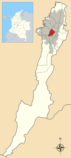
 Location of the locality in the city of Bogotá | |
 Location of the locality in the Capital District of Bogotá | |
| Coordinates: 4°36′45″N 74°06′24″W / 4.61250°N 74.10667°W | |
| Country | |
| City | Bogotá D.C. |
| Area | |
| • Total | 17.31 km2 (6.68 sq mi) |
| Elevation | 2,600 m (8,500 ft) |
| Population (2007)[1] | |
| • Total | 250,715 |
| • Density | 14,000/km2 (38,000/sq mi) |
| Time zone | UTC-5 (Colombia Standard Time) |
| Website | Official website |


Puente Aranda is the 16th location of the Capital District of the Colombian capital city, Bogotá. It is located in the center part of Bogotá. This district is mostly inhabited by lower middle and working class residents. The district was named after an old bridge in the hacienda of Juan Aranda over the "Chinúa River", now called the San Francisco River, that dates to the 16th century. Puente Aranda has 1,724 hectares (4,260 acres) of area which are almost entirely urban. This locality has more than 300,000 inhabitants, 5% of the total urban area inhabitants of Bogota.
- ^ (in Spanish) Population 2007 - DANE