   Highway 114 | ||||
|---|---|---|---|---|
| Ruta 114 | ||||
| Route information | ||||
| Maintained by Puerto Rico DTPW | ||||
| Length | 14.7 km[1] (9.1 mi) | |||
| Major junctions | ||||
| West end | ||||
| East end | ||||
| Location | ||||
| Country | United States | |||
| Territory | Puerto Rico | |||
| Municipalities | Mayagüez, Hormigueros, Cabo Rojo, San Germán | |||
| Highway system | ||||
| ||||
Puerto Rico Highway 114 (PR-114) is a rural road that travels from Mayagüez to San Germán. PR-114 begins at the intersection of PR-2 and Avenida los Corazones in Mayagüez and ends at the intersection with PR-102 at the entrance to the center of San Germán. This road passes through the municipalities of Hormigueros and Cabo Rojo before coming to San Germán.[2][3]
It is a fairly straight road, but is often flooded during periods of heavy rain due to poor drainage and its location near the Guanajibo River.
-
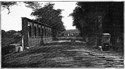 Silva Bridge is at kilometer 4 on Highway 114 (photographed c. 1898 during the Spanish-American War)
.jpg)
- ^ Cite error: The named reference
googlewas invoked but never defined (see the help page). - ^ National Geographic Maps (2011). Puerto Rico (Map). 1:125,000. Adventure Map (Book 3107). Evergreen, Colorado: National Geographic Maps. ISBN 978-1566955188. OCLC 756511572.
- ^ "Tránsito Promedio Diario (AADT)". Transit Data (Datos de Transito) (in Spanish). DTOP PR. pp. 64–65. Archived from the original on 1 April 2019.