General Pulaski Skyway | |
|---|---|
 Looking east at Passaic River crossing, with Hackensack River bridge in background | |
| Coordinates | 40°44′09″N 74°05′30″W / 40.73583°N 74.09167°W |
| Carries | |
| Crosses | Passaic River Hackensack River New Jersey Meadowlands Kearny Point |
| Locale | Jersey City, Kearny, and Newark, New Jersey, United States |
| Maintained by | NJDOT |
| ID number | 0901150 (Hudson County)[1] 0704150 (Essex County)[2] |
| Characteristics | |
| Design | Steel deck truss cantilever bridge over Meadowlands Pratt truss for river crossings |
| Total length | 3.502 mi (5.636 km) (18,492 feet (5,636 m)) |
| Width | 56 ft (17 m) |
| Longest span | 550 ft (168 m) |
| No. of spans | 118[3] |
| Clearance above | 14 ft (4.3 m) |
| Clearance below | 135 ft (41 m) (for river crossings) |
| History | |
| Opened | November 24, 1932 |
Pulaski Skyway | |
| Location | US 1/9 between mileposts 51.25–54.55 |
| Coordinates | 40°44′09″N 74°05′30″W / 40.73583°N 74.09167°W |
| NRHP reference No. | 05000880[4] |
| NJRHP No. | 1526[5] |
| Significant dates | |
| Added to NRHP | August 12, 2005 |
| Designated NJRHP | June 13, 2005 |
| Location | |
 | |
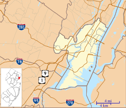
The Pulaski Skyway is a four-lane bridge-causeway in the northeastern part of the U.S. state of New Jersey, carrying a freeway designated U.S. Route 1/9 (US 1/9) for most of its length. The structure has a total length of 3.502 miles (5.636 km). Its longest bridge spans 550 feet (168 m). Traveling between Newark and Jersey City, the roadway crosses the Passaic and Hackensack rivers, Kearny Point, the peninsula between them, and the New Jersey Meadowlands.
Designed by Sigvald Johannesson, the General Casimir Pulaski Skyway opened in 1932 as the last part of the Route 1 Extension, one of the first freeways or "super-highways" in the United States, to provide a connection to the Holland Tunnel. One of several major projects built during the reign of Hudson County political boss Frank Hague, its construction was a source of political and labor disputes. The viaduct is listed in the state and federal registers of historic places.
Unpredictable traffic congestion and its functionally obsolete design make the Skyway one of the most unreliable roads in the United States. As of 2014[update], the bridges handle about 74,000 crossings per day, none of which were by trucks since they had been barred from the road in 1934. The bridges have been altered little since opening. In 2007, the New Jersey Department of Transportation (NJDOT) began a rehabilitation program, which it estimated would cost more than $1 billion and required intermittent closures. The Skyway was closed to eastbound traffic from 2014 to 2018.
- ^ Federal Highway Administration (2012). "NBI Structure Number: 0901150". National Bridge Inventory. Federal Highway Administration.
- ^ Federal Highway Administration (2012). "NBI Structure Number: 0704150". National Bridge Inventory. Federal Highway Administration.
- ^ Parsons Brinckerhoff (PB Americas) (August 19, 2010). Pulaski Skyway Feasibility Assessment Study (PDF) (Report). New Jersey Department of Transportation. p. 23. Retrieved October 18, 2015.
- ^ McCahon, Mary E. & Johnston, Sandra G. (December 2003). "National Register of Historic Places Registration: Route 1 Extension" (PDF). National Park Service. Retrieved March 22, 2013. Additionally, there are accompanying 25 photos from 1929 to 2003. Pulaski Skyway is a contributing property to the "Route 1 Extension".
- ^ Historic Preservation Office (January 18, 2013). "New Jersey and National Registers of Historic Places: Essex County" (PDF). New Jersey Department of Environmental Protection. p. 20. Archived from the original (PDF) on June 19, 2012. Retrieved March 8, 2013.
