Punggol | |
|---|---|
| Other transcription(s) | |
| • Malay | Punggol (Rumi) ڤوڠݢول (Jawi) |
| • Chinese | 榜鹅 (Simplified) 榜鵝 (Traditional) Bǎng'é (Pinyin) Póng-gô (Hokkien POJ) |
| • Tamil | பொங்கோல் Poṅkōl (Transliteration) |
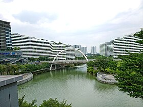
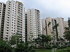
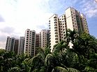
From top left to right: Punggol Town Centre, Flats at Edgedale Plains, Flats at Punggol Cove, Panoramic view of Greendale Secondary School, Watertown, Punggol Plaza, Punggol Waterway Park | |
 Location of Punggol in Singapore | |
| Coordinates: 1°23′53.8″N 103°54′32.3″E / 1.398278°N 103.908972°E | |
| Country | |
| Region | North-East Region
|
| CDC | |
| Town council |
|
| Constituency | |
| Government | |
| • Mayor | North East CDC
|
| • Members of Parliament | Pasir Ris-Punggol GRC
Punggol West SMC |
| Area | |
| • Total | 9.57 km2 (3.69 sq mi) |
| • Residential | 3.74 km2 (1.44 sq mi) |
| Population | |
| • Total | 190,000 |
| • Density | 20,000/km2 (51,000/sq mi) |
| Postal district | 19 |
| Dwelling units | 43,385 |
| Projected ultimate | 96,000 |
Punggol (/ˈpɒŋɡoʊl/ PONG-gohl) is a planning area and new town situated on the Tanjong Punggol peninsula in the North-East Region of Singapore. The town directly borders Sengkang to the south and shares riverine boundaries with the planning area of Seletar to the west and Pasir Ris to the east. Bounding the town to the north and north-east is the Straits of Johor, with Coney Island included as a part of the Punggol planning area.
Under the Punggol 21 initiative, plans to turn the area into a new residential town were announced in 1996 and development of the town started in 1998. Due to the Asian financial crisis in 1997 and the financial troubles within the construction industry in 2003, the plan did not fully materialise. In 2007, a new initiative, the Punggol 21-plus plan, was introduced to redevelop the area into a waterfront town.
Punggol is divided into 11 districts: Canal, Coney Island, Crescent, Matilda, Northshore, Punggol Central, Punggol Field East, Punggol Field West, Punggol Downtown, Punggol Point and Waterway West.[4]
- ^ a b "Punggol (Planning Area, Singapore) - Population Statistics, Charts, Map and Location". www.citypopulation.de.
- ^ a b "Land Area and Dwelling Units by Town". Data Singapore. 2016. Retrieved 26 January 2018.
- ^ "Statistics Singapore - Geographic Distribution - 2018 Latest Data". Retrieved 11 February 2019.
- ^ "HDB to launch BTO projects in Punggol inspired by early zoo, fishing village". CNA. Retrieved 1 September 2019.


