Purathur | |
|---|---|
Village | |
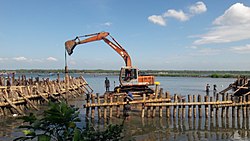
 Padinjarekara Azhimukham at Purathur where the river Bharathappuzha and Tirur River merge together and empties into Arabian Sea (Opposite side is Ponnani port) | |
| Coordinates: 10°48′08″N 75°55′21″E / 10.80222°N 75.92250°E | |
| Country | |
| State | Kerala |
| District | Malappuram |
| Government | |
| • Body | Panchayath |
| Area | |
• Total | 19.15 km2 (7.39 sq mi) |
| Population (2011) | |
• Total | 31,915 |
| • Density | 1,700/km2 (4,300/sq mi) |
| Languages | |
| • Official | Malayalam, English |
| Time zone | UTC+5:30 (IST) |
| PIN | 676102 & 676561 |
| Telephone code | 0494-256 |
| Vehicle registration | KL-55 |
Purathur is a sandy coastal village and a Grama Panchayat in Tirur Taluk, Malappuram district in the state of Kerala, India.[1] Bharathappuzha river and Tirur River merges together in Purathur and join with the Arabian Sea at Padinjarekara Azhimukham, which is also the southernmost tip of Purathur Gram panchayat. Opposite to Padinjarekara Azhimukham is Ponnani port.[2] The village is located at the southernmost tip of Tirur Taluk and is bordered by historically important Ponnani port in Ponnani Municipality of Ponnani taluk to south (Opposite to Padinjarekara Azhimukham).[2]
- ^ "Census of India : Villages with population 5000 & above". Retrieved 10 December 2008.
- ^ a b Directorate of Census Operations, Kerala. District Census Handbook, Malappuram (PDF). Thiruvananthapuram: Directorate of Census Operations, Kerala.
