This article needs additional citations for verification. (September 2009) |
Purnia district | |
|---|---|
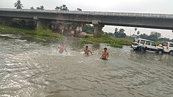
 Saura river near Purnia | |
 Location of Purnia district in Bihar | |
| Country | |
| State | |
| Region | Mithila |
| Division | Purnia |
| Established | 14 February 1770 |
| Headquarters | Purnia |
| Tehsils |
|
| Government | |
| • District Magistrate | Mr. Kundan Kumar, IAS[1] |
| • Lok Sabha constituencies | Purnia, Katihar, Araria and Kishanganj |
| • Vidhan Sabha constituencies | Amour, Baisi, Kasba, Banmankhi, Rupauli, Dhamdaha, Purnia, |
| Area | |
| • Total | 3,229 km2 (1,247 sq mi) |
| Population (2011) | |
| • Total | 3,264,619 |
| • Density | 1,000/km2 (2,600/sq mi) |
| Demographics | |
| • Literacy | 72.09 per cent |
| • Sex ratio | 921 |
| • Major ethnolinguistic group | Maithils[2] |
| Language | |
| • Official | Hindi[3] |
| • Additional official | Urdu[3] |
| • Regional Languages | Maithili |
| Time zone | UTC+05:30 (IST) |
| Vehicle registration | BR-11 |
| Major highways | |
| Major Railway Lines | |
| Website | purnea |
Purnia District is one of the thirty-eight districts of the Indian state of Bihar. The city of Purnia is the administrative headquarters of this district. The city of Purnia has continued its tradition of hoisting the national flag at 12:07 am on every Independence Day since 1947. Purnia district is a part of Purnia Division. The district extends northwards from the Ganges river.
- ^ "बिहार: पूर्णिया में SDM रहे कुंदन कुमार की Dm के रूप में वापसी, पीएम अवार्ड से सम्मानित, जानिए कारनामे".
- ^ "Election Results in Hindi (चुनाव परिणाम): West Bengal, Kerala, Assam, Tamil Nadu and Puducherry Election News in Hindi".
- ^ a b "52nd Report of the Commissioner for Linguistic Minorities in India" (PDF). nclm.nic.in. Ministry of Minority Affairs. Archived from the original (PDF) on 25 May 2017. Retrieved 22 January 2019.