| Purple Mountain (and Purple Mountain Group) | |
|---|---|
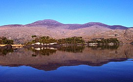
 Purple Mountain from the south with the Killarney Upper Lake in the foreground | |
| Highest point | |
| Elevation | 832 m (2,730 ft)[1][2] |
| Prominence | 597 m (1,959 ft)[1] |
| Listing | Marilyn, Hewitt, Arderin, Simm, Vandeleur-Lynam |
| Coordinates | 52°00′28″N 9°37′21″W / 52.007906°N 9.62251°W[1] |
| Naming | |
| Native name | An Sliabh Corcra |
| Geography | |
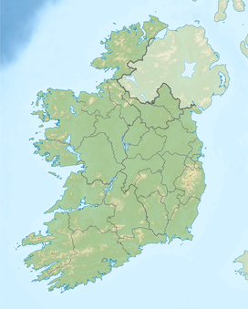
County Kerry, Ireland | |
| Parent range | Purple Mountain Group |
| OSI/OSNI grid | V886851 |
| Topo map | OSI Discovery 78 |
| Geology | |
| Rock age | Devonian |
| Mountain type(s) | Well-bedded grey sandstone, (Lough Acoose Sandstone Formation)[1] |
| Climbing | |
| Easiest route | From the Head of the Gap |
Purple Mountain (Irish: an Sliabh Corcra)[3] at 832 metres (2,730 ft) high, is the 21st–highest peak in Ireland on the Arderin scale, and the 28th–highest according to the Vandeleur-Lynam scale. It is located in County Kerry, and is the highest point of the Purple Mountain Group.
- ^ a b c d MountainViews: Purple Mountain
- ^ Peakbagger
- ^ Tempan, Paul (February 2012). "Irish Hill and Mountain Names" (PDF). MountainViews.ie.
