Purwa | |
|---|---|
 Map of Purwa CD block | |
| Coordinates: 26°28′N 80°47′E / 26.47°N 80.78°E | |
| Country | |
| State | Uttar Pradesh |
| District | Unnao |
| Area | |
| • Total | 3.74 km2 (1.44 sq mi) |
| Elevation | 129 m (423 ft) |
| Population (2001)[1] | |
| • Total | 24,467 |
| • Density | 6,500/km2 (17,000/sq mi) |
| Languages | |
| • Official | Hindi |
| Time zone | UTC+5:30 (IST) |
Purwa is a town and nagar panchayat in Unnao district, Uttar Pradesh, India.[1] It is located 32 km southeast of Unnao, the district headquarters.[3] Roads connect it with several major cities including Unnao, Lucknow, Kanpur, and Rae Bareli.[4] As of 2011, its population is 24,467 people, in 4,128 households.[1]
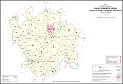
Purwa is the headquarters of a community development block, which was first inaugurated on 1 April 1959 in order to oversee implementation of India's Five-Year Plans at a local and rural level.[3] Most of the block lies within the tehsil of Purwa, but parts are in the tehsil of Bighapur instead.[1] As of 2011, the block comprises 112 rural villages (including Asoha itself), with a total population of 125,619 people in 25,020 households.[1]
- ^ a b c d e f "Census of India 2011: Uttar Pradesh District Census Handbook - Unnao, Part A (Village and Town Directory)". Census 2011 India. pp. 348–72, 525–44. Retrieved 9 July 2021.
- ^ Cite error: The named reference
Census 1981was invoked but never defined (see the help page). - ^ a b Baghel, Amar Singh (1979). Uttar Pradesh District Gazetteers: Unnao. Rampur: Government Press. pp. 150–2, 268–9. Retrieved 9 July 2021.
- ^ Nevill, H.R. (1903). Unao: A Gazetteer, Being Volume XXXVIII Of The District Gazetteers Of The United Provinces Of Agra And Oudh. Allahabad: Government Press. pp. 121, 123, 221–30. Retrieved 10 July 2021.
