Putnam County | |
|---|---|
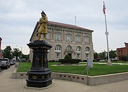
 Putnam County Courthouse | |
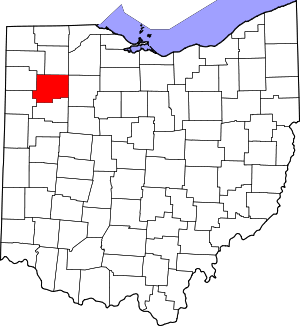
 Location within the U.S. state of Ohio | |
 Ohio's location within the U.S. | |
| Coordinates: 41°01′N 84°08′W / 41.02°N 84.13°W | |
| Country | |
| State | |
| Founded | January 3, 1834 |
| Named for | Israel Putnam |
| Seat | Ottawa |
| Largest village | Ottawa |
| Area | |
• Total | 484 sq mi (1,250 km2) |
| • Land | 483 sq mi (1,250 km2) |
| • Water | 1.8 sq mi (5 km2) 0.4% |
| Population (2020) | |
• Total | 34,451 |
| • Density | 71/sq mi (27/km2) |
| Time zone | UTC−5 (Eastern) |
| • Summer (DST) | UTC−4 (EDT) |
| Congressional district | 5th |
| Website | www |
Putnam County is a county located in the northwestern part of the U.S. state of Ohio. As of the 2020 census, the population was 34,451.[1] Its county seat is Ottawa.[2] The county was created in 1820 and later organized in 1834.[3] Its name is in honor of Israel Putnam, a colonial officer in the French and Indian War, who served as a general in the American Revolutionary War.[4] The Blanchard River, which passes through the county, was a key transportation route for early European-American settlers.
- ^ 2020 census
- ^ "Find a County". National Association of Counties. Retrieved June 7, 2011.
- ^ "Ohio: Individual County Chronologies". Ohio Atlas of Historical County Boundaries. The Newberry Library. 2007. Archived from the original on April 6, 2016. Retrieved February 14, 2015.
- ^ Warren, Robert (May 31, 1953). "Blanchard River Brought Pioneers To Putnam". Toledo Blade. p. 3. Retrieved April 30, 2015.

