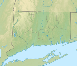
| Putnam Memorial State Park | |
|---|---|
 Equestrian statue of Israel Putnam at the entrance to Putnam Memorial State Park | |
| Location | Redding, Connecticut, United States |
| Coordinates | 41°20′23″N 73°22′45″W / 41.33972°N 73.37917°W[1] |
| Area | 183 acres (74 ha)[2] |
| Elevation | 591 ft (180 m)[1] |
| Established | 1887 |
| Administered by | Connecticut Department of Energy and Environmental Protection |
| Designation | Connecticut state park |
| Website | Official website |
Putnam Memorial State Park | |
 Site of log huts on Company Street | |
| Location | Jct. of Rtes. 58 (Black Rock Tpke.) and 107 (Park Rd.), Redding, Connecticut |
| Area | 183 acres (74 ha) |
| Built | 1778 |
| NRHP reference No. | 70000683 |
| Added to NRHP | December 29, 1970 |
Putnam Memorial State Park is a history-oriented public recreation area in the town of Redding, Connecticut.[3] The state park preserves the site that Major General Israel Putnam chose as the winter encampment for his men in the winter of 1778/1779 during the American Revolutionary War.[4] It is Connecticut's oldest state park, created in 1887 at the instigation of Redding town residents. The park was listed on the National Register of Historic Places in 1970.[5]
In addition to its historic features, the park's 183 acres (74 ha) include facilities for hiking, picnicking, pond fishing, and winter sports. The park is located at the intersection of Route 107 and Route 58 and is managed by the Connecticut Department of Energy and Environmental Protection.[3]
- ^ a b "Putnam Park Pond". Geographic Names Information System. United States Geological Survey, United States Department of the Interior.
- ^ Cite error: The named reference
pristaffwas invoked but never defined (see the help page). - ^ a b Cite error: The named reference
DEEPwas invoked but never defined (see the help page). - ^ Cite error: The named reference
hubbardwas invoked but never defined (see the help page). - ^ Cite error: The named reference
nrhpwas invoked but never defined (see the help page).

