| Putorana Plateau | |
|---|---|
| Путорана | |
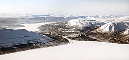
 Landscape of the Putorana area | |
| Highest point | |
| Peak | Mount Kamen |
| Elevation | 1,678[1] m (5,505 ft) |
| Dimensions | |
| Length | 800 km (500 mi) |
| Width | 500 km (310 mi) |
| Geography | |
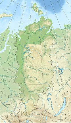
Location in Krasnoyarsk Krai, Russia | |
| Country | Russia |
| Federal subject | Krasnoyarsk Krai |
| Range coordinates | 69°0′N 93°30′E / 69.000°N 93.500°E |
| Parent range | Central Siberian Plateau |
| Borders on | North Siberian Lowland Tunguska Plateau Syverma Plateau |
| Geology | |
| Rock age | Paleozoic |
| Rock type(s) | Basalt, trap rock |
| Climbing | |
| Easiest route | From Norilsk and Talnakh |
| UNESCO World Heritage Site | |
|---|---|
 | |
| Location | Krasnoyarsk Krai, Russia, Asia |
| Criteria | Natural: (vii), (ix) |
| Reference | 1234rev |
| Inscription | 2010 (34th Session) |
| Area | 1,887,251 ha (4,663,500 acres) |
| Buffer zone | 1,773,300 ha (4,382,000 acres) |
| Website | zapovedsever |
| Coordinates | 69°2′49″N 94°9′29″E / 69.04694°N 94.15806°E |

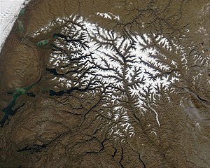
The Putorana Plateau (Russian: плато Путорана, romanized: plato Putorana) or the Putorana Mountains is a mountainous area in the Russian Federation. It is a large massif or plateau crossed by mountain ranges. The nearest large settlement is Norilsk, where foreign travel is restricted. The city is served by Alykel Airport.
The area of the mountains contains some of the largest known nickel deposits in the world.


