| Pyramid Lake | |
|---|---|
| |
 The tufa formation that gives Pyramid Lake its name. | |
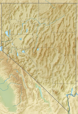
| Location | Washoe County, Nevada, United States |
| Coordinates | 40°03′45″N 119°33′49″W / 40.06250°N 119.56361°W |
| Lake type | endorheic salt lake |
| Etymology | pyramidal limestone columns |
| Primary inflows | Truckee River |
| Catchment area | 1,825.8 sq mi (4,729 km2) |
| Max. length | 29.8 mi (48.0 km) |
| Max. width | 8.7 mi (14.0 km) |
| Surface area | 188 sq mi (490 km2) |
| Max. depth | 356 ft (109 m) |
| Water volume | 23,660,000 acre-feet (29.18 km3) |
| Surface elevation | 3,796 ft (1,157 m) (1980 data)[1] |
| Islands | Anaho Island |
| References | GNIS ID: 856349[1] |
| Reference no. | 18 |
Pyramid Lake is the geographic sink of the basin of the Truckee River, 40 mi (64 km) northeast of Reno, Nevada, United States.
Pyramid Lake is the biggest remnant of ancient Lake Lahontan, the inland sea that once covered much of western Nevada.[2] It is approximately 27 miles (43 km) long and 11 miles (18 km) wide, with a perimeter of 71 miles (114 km), covering 112,000 acres (45,000 ha) acres entirely enclosed within the Pyramid Lake Paiute Tribe Reservation.[3]
Pyramid Lake is fed by the Truckee River, which is mostly the outflow from Lake Tahoe. The Truckee River enters Pyramid Lake at its southern end. Pyramid Lake is an endorheic lake, with water leaving only by evaporation or sub-surface seepage. The lake has about 10% of the area of the Great Salt Lake, but it has about 25% more volume. The salinity is approximately 1/6 that of sea water. Although clear Lake Tahoe forms the headwaters that drain to Pyramid Lake, the Truckee River delivers more turbid waters to Pyramid Lake after traversing the steep Sierra terrain and collecting moderately high silt-loaded surface runoff.
The north and east sides of the lake have been restricted to the public and non-Tribal members since 2011, when the Tribal Nation made the decision to close these areas due to the desecration of sacred sites. When visiting, it is recommended to take note of the Tribal protocols and restricted areas.[2]
- ^ a b "Query Form For The United States And Its Territories". U.S. Board on Geographic Names. Retrieved 2010-05-18.
U.S. Geological Survey Geographic Names Information System: Pyramid Lake (856349); The Pyramid (848623), The Needle Rocks (847213) - ^ a b "Pyramid Lake Nevada | The official site for the Pyramid Lake Paiute Tribe, Nevada". Retrieved 2021-01-31.
- ^ "Home". Pyramid Lake Paiute Tribe.

