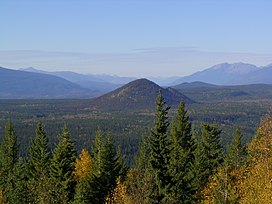
| Pyramid Mountain | |
|---|---|
 Pyramid Mountain, Sept. 2006 | |
| Highest point | |
| Elevation | 1,094 m (3,589 ft)[1] |
| Prominence | 227 m (745 ft)[1] |
| Coordinates | 51°59′40″N 120°06′16″W / 51.99444°N 120.10444°W[2] |
| Geography | |
 | |
| Interactive map of Pyramid Mountain | |
| Location | British Columbia, Canada |
| District | Kamloops Division Yale Land District |
| Topo map | NTS 92P16 Mahood Lake |
| Geology | |
| Rock age | Pleistocene |
| Mountain type | Subglacial mound |
| Volcanic field | Wells Gray-Clearwater volcanic field |
| Last eruption | 12,000 years ago |
| Climbing | |
| Easiest route | Trail off Majerus Falls trail |
Pyramid Mountain is a subglacial mound located on the Murtle Plateau in Wells Gray Provincial Park, east-central British Columbia, Canada.
- ^ a b "Pyramid Mountain". Bivouac.com. Retrieved 2013-08-10.
- ^ "Pyramid Mountain". BC Geographical Names. Retrieved 2013-08-10.
