| Qbajjar Bay | |
|---|---|
| Il-Qbajjar | |
 Qolla Il-Bajda with the Qolla Il-Bajda Battery to the right | |
| Location | Marsalforn, Gozo, Malta |
| Coordinates | 36°04′38″N 14°15′10″E / 36.07722°N 14.25278°E |
| Part of | Mediterranean Sea |
| Max. length | 370 metres (1,210 ft) |
| Max. width | 330 metres (1,080 ft) |
| Surface area | 4.3 hectares (0.043 km2) |
| Surface elevation | 26 feet (7.9 m) |
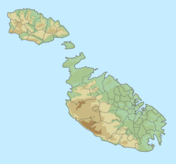
Qbajjar Bay (Maltese: Il-Qbajjar) is a small bay near Marsalforn, in the limits of Żebbuġ on the island of Gozo, Malta. This small bay is part of Marsalforn. It is located between Xwejni Bay to the west, and Marsalforn Bay to the east. The 18th century Qolla l-Bajda Battery, one of the few surviving coastal fortifications in Gozo, is located between Qbajjar and Xwejni, on a promontory known as il-Ponta tat-Torri. The bay, also has a few salt pans, where locals collect salt.[1][2][3]
- ^ Camilleri, Alex (2009). "It-Toponomastika t'Għawdex: Ix-Xtut taż-Żebbuġ, l-Għasri, u l-Għarb" (PDF). L-Imnara (in Maltese). 9 (2). Għaqda tal-Folklor: 73. Archived from the original (PDF) on 17 April 2016.
- ^ "Marsalforn Culture & History". Żebbuġ Local Council. Archived from the original on 13 March 2016.
- ^ "Saltpans". visitgozo.com. Retrieved 2019-07-04.

