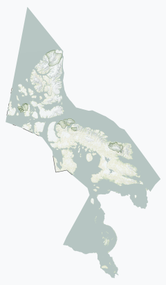
Qikiqtaaluk
ᕿᑭᖅᑖᓗᒃ (Inuktitut) | |
|---|---|
| Qikiqtaaluk Region | |
Communities of the Qikiqtaaluk | |
 Location in Nunavut | |
| Country | Canada |
| Territory | Nunavut |
| Regional centre | Iqaluit |
| Area | |
• Total | 989,879.35 km2 (382,194.55 sq mi) |
| Population | |
• Total | 18,988 |
| • Density | 0.019/km2 (0.050/sq mi) |
The Qikiqtaaluk Region, Qikiqtani Region (Inuktitut syllabics: ᕿᑭᖅᑖᓗᒃ pronounced [qikiqtaːˈluk]) or the Baffin Region is the easternmost,[1] northernmost, and southernmost administrative region of Nunavut, Canada. Qikiqtaaluk is the traditional Inuktitut name for Baffin Island.[2] Although the Qikiqtaaluk Region is the most commonly used name in official contexts, several notable public organizations, including Statistics Canada prior to the 2021 Canadian census,[3] use the older term Baffin Region.
With a population of 18,988 and an area of 989,879.35 km2 (382,194.55 sq mi), it is the largest and most populated of the three regions.[3] It is also the largest second-level administrative division in the world.
The region consists of Baffin Island, the Belcher Islands, Akimiski Island, Mansel Island, Prince Charles Island, Bylot Island, Devon Island, Baillie-Hamilton Island, Cornwallis Island, Bathurst Island, Amund Ringnes Island, Ellef Ringnes Island, Axel Heiberg Island, Ellesmere Island, the Melville Peninsula, the eastern part of Melville Island, and the northern parts of both Prince of Wales Island and Somerset Island, plus smaller islands in between. The regional centre, and territorial capital, is Iqaluit (population 7,740).[4] The Qikiqtaaluk Region spans the northernmost, easternmost, and southernmost areas of Nunavut.
Before 1999, the Qikiqtaaluk Region existed under slightly different boundaries in the Northwest Territories as the Baffin Region, in the northern part of the District of Keewatin.
The western half of the nearby Hans Island is part of the Qikiqtaaluk, while the eastern half is part of Greenland and is in the municipality of Avannaata.
- ^ Philip Goldring (Winter 2015). "Historians and Inuit: learning from the Qikiqtani Truth Commission, 2007-2010". Canadian Journal of History. 50 (3). University of Toronto via GALE: 492–523. doi:10.3138/CJH.ACH.50.3.005. S2CID 146493747. Archived from the original on May 6, 2016. Retrieved April 19, 2016.
- ^ IHT’s Nunavut Map Series
- ^ a b "Census Profile, 2016 Census Baffin, Region [Census division]". Statistics Canada. Retrieved March 2, 2017.
- ^ "Census Profile, 2016 Census Iqaluit". Statistics Canada. Retrieved March 2, 2017.
