Queen Anne's County | |
|---|---|
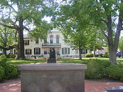
 Queen Anne's County Courthouse in Centreville, Maryland | |
 Location within the U.S. state of Maryland | |
 Maryland's location within the U.S. | |
| Coordinates: 39°02′N 76°05′W / 39.03°N 76.08°W | |
| Country | |
| State | |
| Founded | 1706 |
| Named for | Queen Anne |
| Seat | Centreville |
| Largest community | Stevensville |
| Area | |
• Total | 511 sq mi (1,320 km2) |
| • Land | 372 sq mi (960 km2) |
| • Water | 139 sq mi (360 km2) 27% |
| Population (2020) | |
• Total | 49,874 |
| • Density | 98/sq mi (38/km2) |
| Time zone | UTC−5 (Eastern) |
| • Summer (DST) | UTC−4 (EDT) |
| Congressional district | 1st |
| Website | www |
Queen Anne's County is a county located in the U.S. state of Maryland. As of the 2020 census, the population was 49,874.[1] Its county seat and most populous municipality is Centreville.[2] The census-designated place of Stevensville is the county's most populous place with a population of 7,442 as of 2020. The county is named for Queen Anne of Great Britain, who reigned when the county was established in 1706 during the colonial period. The county is part of the Mid-Eastern Shore region of the state.
Queen Anne's County is included in the Baltimore-Columbia-Towson, MD Metropolitan Statistical Area, which is also included in the Washington-Baltimore-Arlington, DC-MD-VA-WV-PA Combined Statistical Area, and is the easternmost in both.
Chesapeake Bay Bridge connects Kent Island in Queen Anne's County across Chesapeake Bay to Anne Arundel County. The American Discovery Trail runs through the county.
- ^ "State & County QuickFacts". United States Census Bureau. Archived from the original on September 5, 2015. Retrieved August 24, 2013.
- ^ "Find a County". National Association of Counties. Archived from the original on May 31, 2011. Retrieved June 7, 2011.

