Quilcene, Washington | |
|---|---|
| Nickname: "Pearl of the Peninsula" | |
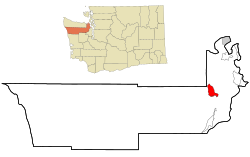
 Location of Quilcene, Washington | |
| Coordinates: 47°49′55″N 122°53′7″W / 47.83194°N 122.88528°W[1] | |
| Country | United States |
| State | Washington |
| County | Jefferson |
| Area | |
• Total | 9.2 sq mi (23.8 km2) |
| • Land | 8.8 sq mi (22.8 km2) |
| • Water | 0.4 sq mi (1.0 km2) |
| Elevation | 43 ft (13 m) |
| Population (2020) | |
• Total | 598 |
| • Density | 65/sq mi (25/km2) |
| Time zone | UTC-8 (Pacific (PST)) |
| • Summer (DST) | UTC-7 (PDT) |
| ZIP code | 98376 |
| Area code | 360 |
| FIPS code | 53-56975[2] |
| GNIS feature ID | 1524768[3] |
Quilcene is an unincorporated community and census-designated place (CDP) in Jefferson County, Washington, United States. The population was 598 at the 2020 census.
The community is located on the Olympic Peninsula at the head of Quilcene Bay, an arm of the seawater-filled glacial valley of Hood Canal.[4] Each year many visitors enjoy the panoramic views of Mount Rainier, Puget Sound and Seattle from the 2,804-foot (855 m) summit of nearby Mount Walker, the only peak facing Puget Sound that has a road to its summit.[4] The Olympic National Forest lands in Quilcene hold Douglas fir, spring-blooming Pacific rhododendrons, Oregon grape, and salal.[5] Leland Lake is located north of Quilcene.
Quilcene oysters are named after the community.[6] Quilcene has one of the largest oyster hatcheries in the world.[citation needed]
- ^ "US Gazetteer files: 2010, 2000, and 1990". United States Census Bureau. February 12, 2011. Retrieved April 23, 2011.
- ^ "U.S. Census website". United States Census Bureau. Retrieved January 31, 2008.
- ^ "Quilcene". Geographic Names Information System. United States Geological Survey, United States Department of the Interior.
- ^ a b Washington Byways Guide Book, Tony Huegel, Wilderness Press, 2003, ISBN 0-89997-299-3.
- ^ Mt. Walker Trail #894, Olympic National Forest.
- ^ "Scenic Driving Washington", Steve Giordano, Globe Pequot, Falcon Guides Scenic Driving, 1997, ISBN 1-56044-577-7. p. 80