| Quilpie Queensland | |||||||||||||||
|---|---|---|---|---|---|---|---|---|---|---|---|---|---|---|---|
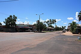
 Brolga St, the main street of Quilpie | |||||||||||||||
| Coordinates | 26°36′58″S 144°16′03″E / 26.6161°S 144.2675°E | ||||||||||||||
| Population | 530 (2021 census)[1] | ||||||||||||||
| • Density | 0.02970/km2 (0.0769/sq mi) | ||||||||||||||
| Established | 1917 | ||||||||||||||
| Postcode(s) | 4480 | ||||||||||||||
| Area | 17,847.0 km2 (6,890.8 sq mi) | ||||||||||||||
| Time zone | AEST (UTC+10:00) | ||||||||||||||
| Location |
| ||||||||||||||
| LGA(s) | Shire of Quilpie | ||||||||||||||
| State electorate(s) | Warrego | ||||||||||||||
| Federal division(s) | Maranoa | ||||||||||||||
| |||||||||||||||
Quilpie (/ˈkwɪlpi/ KWIL-pee) is a rural town and locality in the Shire of Quilpie, Queensland, Australia.[2][3] In the 2021 census, the locality of Quilpie had a population of 530 people.[1]
The town is the administrative centre of the Quilpie Shire local government area. The town of Toompine is also within the locality.
The economy of the area is based on the grazing and mining industries. The area has one of the largest deposits of boulder opal in the world, and also has extensive deposits of gas and oil.
- ^ a b Cite error: The named reference
Census2021was invoked but never defined (see the help page). - ^ "Quilpie – town in Shire of Quilpie (entry 27822)". Queensland Place Names. Queensland Government. Retrieved 30 November 2019.
- ^ "Quilpie – locality in Shire of Quilpie (entry 50254)". Queensland Place Names. Queensland Government. Retrieved 30 November 2019.
