| R581 road | |
|---|---|
| Bóthar R581 | |
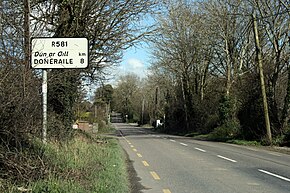
 R581 leaving the N20 (between New Twopothouse village and Old Twopothouse crossroads) | |
| Route information | |
| Length | 8 km (5.0 mi) |
| Location | |
| Country | Ireland |
| Primary destinations | |
| Highway system | |
The R581 road is a regional road in Ireland which runs from the N20 at New Twopothouse village to Doneraile in County Cork.
The road is 8km long.
In 2012 and 2013 the R581 was realigned to straighten it and to bypass some habitations. In 2011 archeological investigations in advance of the realignment were conducted by Rubicon Heritage and revealed the site of the former Caherduggan Castle east of Old Twopothouse at 52°11′53″N 8°37′41″W / 52.1981°N 8.6281°W.[1]
- ^ Nicholl 2016: "The remains of a towerhouse, an adjacent well and a surrounding ditch were revealed."
