| RAF Culmhead RAF Church Stanton | |||||||||||
|---|---|---|---|---|---|---|---|---|---|---|---|
| Churchstanton, Somerset in England | |||||||||||
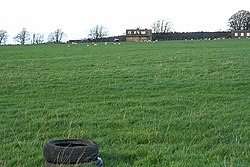
 The old control tower taken in 2006 | |||||||||||
| Coordinates | 50°55′46″N 003°07′42″W / 50.92944°N 3.12833°W | ||||||||||
| Type | Royal Air Force station | ||||||||||
| Code | UC[1] | ||||||||||
| Site information | |||||||||||
| Owner | Air Ministry | ||||||||||
| Operator | Royal Air Force Royal Navy | ||||||||||
| Controlled by | RAF Fighter Command 1941-44 * No. 10 Group RAF RAF Flying Training Command 1944- * No. 23 Group RAF[1] | ||||||||||
| Site history | |||||||||||
| Built | 1941 | ||||||||||
| In use | August 1941 – August 1946 | ||||||||||
| Battles/wars | European theatre of World War II | ||||||||||
| Airfield information | |||||||||||
| Elevation | 263 metres (863 ft)[1] AMSL | ||||||||||
| |||||||||||
Royal Air Force Culmhead or more simply RAF Culmhead is a former Royal Air Force station, situated at Churchstanton on the Blackdown Hills in Somerset, England. It was originally named RAF Church Stanton.
It had three tarmac runways that are now in poor condition and the control towers are currently derelict. There is now an industrial estate – derived from the later Composite Signals Organisation Station (CSOS) – right in the middle of the place where the three runways meet.[2]
- ^ a b c Falconer 2012, p. 74.
- ^ "RAF Culmhead". South West Airfields Heritage Trust. Retrieved 22 January 2011.

