R-2
Radial Road 2 | |
|---|---|
| R-2 Road | |
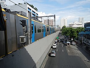
 Taft Avenue, a portion of R-2, in Ermita, Manila | |
| Route information | |
| Maintained by the Department of Public Works and Highways and the Metropolitan Manila Development Authority[a] | |
| Length | 56.51 km (35.11 mi) |
| Component highways | |
| Major junctions | |
| North end | |
| South end | |
| Location | |
| Country | Philippines |
| Provinces | Cavite |
| Major cities | Bacoor, Dasmariñas, Imus, Las Piñas, Manila, Parañaque, Pasay, and Tagaytay |
| Towns | Silang |
| Highway system | |
| |
Radial Road 2 (R-2), informally known as the R-2 Road, is a network of roads and bridges which comprise the second arterial road of Metro Manila in the Philippines.[1] Spanning some 56.51 kilometers (35.11 mi), it connects the cities and municipalities of Bacoor, Dasmariñas, Imus, Las Piñas, Manila, Parañaque, Pasay, Silang, and Tagaytay in Cavite and Metro Manila.
Cite error: There are <ref group=lower-alpha> tags or {{efn}} templates on this page, but the references will not show without a {{reflist|group=lower-alpha}} template or {{notelist}} template (see the help page).
- ^ "Metro Manila Infrastructure Development" (PDF). University of the Philippines Diliman. Archived (PDF) from the original on August 10, 2017. Retrieved March 12, 2021.