Rainy River | |
|---|---|
| Town of Rainy River | |
| Coordinates: 48°43′N 94°34′W / 48.717°N 94.567°W | |
| Country | Canada |
| Province | Ontario |
| District | Rainy River |
| Settled | 1895 |
| Incorporated | 1901 (township) |
| Incorporated | 1902 (town) |
| Government | |
| • Type | Town |
| • Mayor | Deborah Ewald |
| • Federal riding | Thunder Bay—Rainy River |
| • Prov. riding | Kenora—Rainy River |
| Area | |
| • Land | 3.11 km2 (1.20 sq mi) |
| Population (2016)[1] | |
• Total | 807 |
| • Density | 259.9/km2 (673/sq mi) |
| Time zone | UTC−6 (CST) |
| • Summer (DST) | UTC−5 (CDT) |
| Postal code | P0W 1L0 |
| Area code | 807 |
| Website | www.rainyriver.ca |


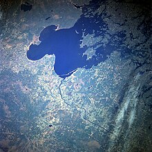
Rainy River is a town in north-western Ontario, Canada, southeast of Lake of the Woods. Rainy River is situated on the eponymous Rainy River, which forms part of the Ontario–Minnesota segment of the Canada–US border. Across the river is the town of Baudette, Minnesota. The two towns are connected by the Baudette – Rainy River International Bridge. Rainy River is at the northwestern terminus of Highway 11.
Rainy River was frequently thought to have been the northwestern terminus of Yonge Street (which runs north from Toronto) due to it being incorrectly thought as being synonymous with the entire length of Highway 11. Because of this incorrect conflation, Yonge Street was considered the longest street in the world and was listed as such in the Guinness Book of World Records until 1999.[2] Highway 11 is named Atwood Avenue through Rainy River, although the town and the City of Toronto both maintain commemorative markers at each end.
- ^ a b "Census Profile, 2016 Census: Rainy River, Town". Statistics Canada. Retrieved July 1, 2019.
- ^ Young, Mark C. (1999). Guinness Book of World Records. Bantam. ISBN 0-553-58075-2. Retrieved February 16, 2010.


