Rajgarh district | |
|---|---|
Narsinghgarh fort | |
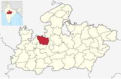
 Location of Rajgarh district in Madhya Pradesh | |
| Coordinates (Rajgarh (Madhya Pradesh)): 24°15′37″N 74°56′42″E / 24.26028°N 74.94500°E | |
| Country | |
| State | Madhya Pradesh |
| Division | Bhopal |
| Headquarters | Rajgarh (Madhya Pradesh) |
| Tehsils | 8 |
| Government | |
| • Lok Sabha constituencies | Rajgarh |
| Area | |
• Total | 6,154 km2 (2,376 sq mi) |
| Population (2011) | |
• Total | 1,545,814 |
| • Density | 250/km2 (650/sq mi) |
| Demographics | |
| • Literacy | 61.21 % |
| Time zone | UTC+05:30 (IST) |
| Major highways | NH-3, NH-46 |
| Website | rajgarh |
Rajgarh district is a district of Madhya Pradesh in central India. The city of Rajgarh is the administrative headquarters of the district. The old name of Rajgarh was Jhanjhanipur. Rajgarh in Madhya Pradesh is one of the aspirational districts selected by Government of India. The district has an area of 6,154 km² and the population is 1,545,814 (2011 census).[1] The district lies on the northern edge of the Malwa plateau, and the Parbati River forms the eastern boundary of the district, while the Kali Sindh River forms the western boundary. The district has seven tehsils, Rajgarh, Khilchipur, Jirapur, Biaora, Narsinghgarh, Sarangpur and Pachore. The district is bounded by Rajasthan state to the north, and by the districts of Guna to the northeast, Bhopal to the east, Sehore to the southeast, and Shajapur to the south and west. It is part of Bhopal Division. There are 1728 villages in Rajgarh.
The district was created May 1948, and includes the territory of the former princely states of Rajgarh, Narsinghgarh, Khilchipur, and parts of the states of Dewas Junior and Senior (Sarangpur tehsil) and Indore (Jirapur tehsil, now part of Khilchipur tehsil).
In addition to the town of Rajgarh, Khilchipur, Kotravihar, Narsinghgarh and Kurawar are places of interest.

