 NASA picture of Rakahanga | |
 | |
| Geography | |
|---|---|
| Location | Central-Southern Pacific Ocean |
| Coordinates | 10°02′S 161°05′W / 10.033°S 161.083°W |
| Archipelago | Cook Islands |
| Total islands | 11 |
| Major islands | Rakahanga |
| Area | 4 km2 (1.5 sq mi) |
| Administration | |
| Largest settlement | Rakahanga |
| Demographics | |
| Population | 83 |
| Pop. density | 32/km2 (83/sq mi) |
| Ethnic groups | Nu-matua, Tia-ngaro-tonga |

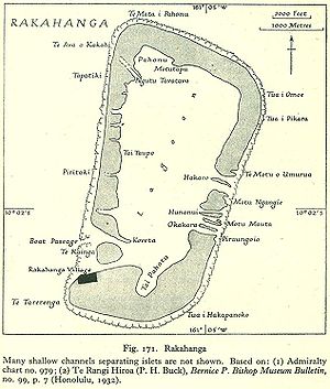
Rakahanga is part of the Cook Islands, situated in the central-southern Pacific Ocean. The unspoilt atoll is 1,248 kilometres (775 miles) from the Cook Islands' capital, Rarotonga, and lies 1,111 kilometres (690 miles) south of the equator. Its nearest neighbour is Manihiki which is just 44 kilometres (27 miles) away. Rakahanga's area is 4 square kilometres (1.5 sq mi). Its highest point is approximately 5 metres above sea level. The population was 83 in the 2016 Census of Population & Dwellings, with a density ratio of 32 people per square kilometer. Since 2014 Rakahanga's electricity has been 100% solar generated. The Rakahanga-Manihiki language differs from Cook Islands Maori.