Ramsgate Airport RAF Ramsgate | |||||||||||
|---|---|---|---|---|---|---|---|---|---|---|---|
| Summary | |||||||||||
| Airport type | Closed | ||||||||||
| Serves | Ramsgate | ||||||||||
| Elevation AMSL | 163 ft / 50 m | ||||||||||
| Coordinates | 51°21′14.67″N 1°24′27.52″E / 51.3540750°N 1.4076444°E | ||||||||||
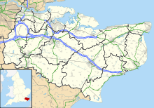
| Map | |||||||||||
 | |||||||||||
| Runways | |||||||||||
| |||||||||||
Ramsgate Airport was a civil airfield at Ramsgate, Kent, United Kingdom which opened in July 1935. It was briefly taken over by the Royal Air Force in the Second World War, becoming RAF Ramsgate. The airfield was then closed and obstructed to prevent its use. It reopened in 1953 and served until final closure in 1968. The site has now been redeveloped as an industrial estate.
